
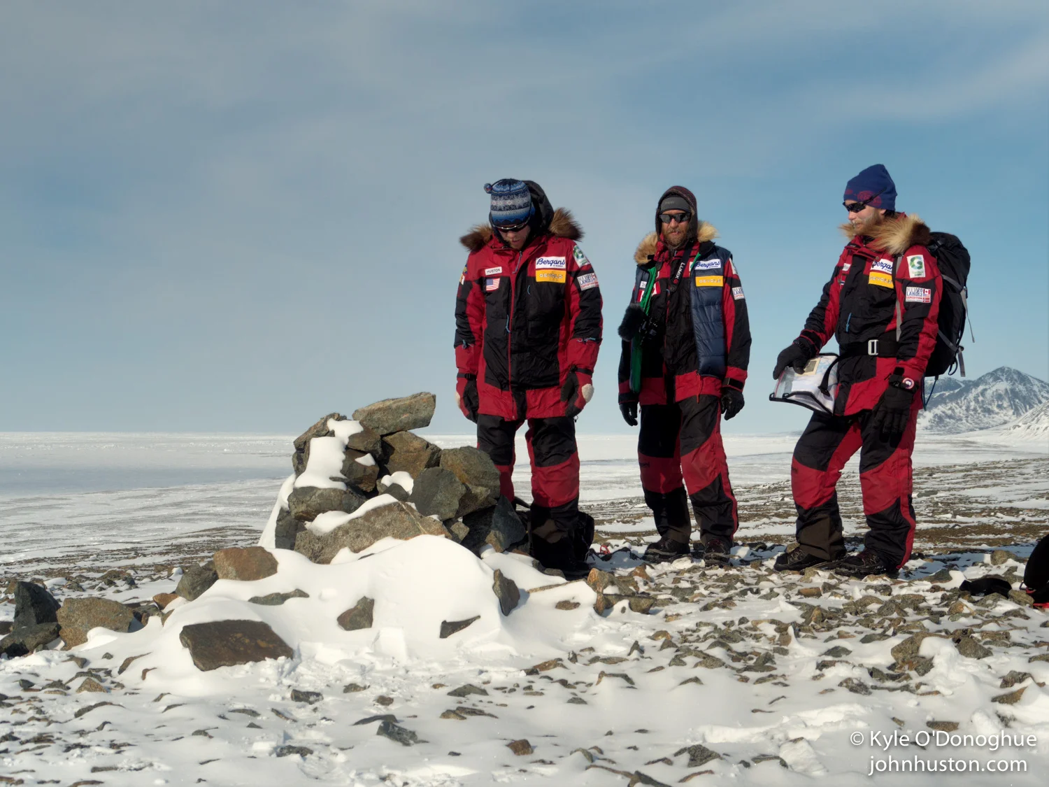
The cairn
by John Huston
Based on our resources, which include Otto Sverdrup’s book New Land and his personal journal from the second Fram expedition, we believe that we have found the cairn he built in May of 1902 near Lands Lokk.
Toby first sighted the cairn last night around midnight as he and Kyle went for one last look around the area before we headed back south. We think the exact location of this cairn has been unknown for a long time. It appears the cairn is very old and well built and that it has been previously opened. When we opened it today, we found nothing inside.
Find the cairn
Cairns were built for purposes of surveying and as a means of communication. Explorers sometimes left notes indicating their travel plans or even mail to be sent home. This cairn marks the northern end point of the second Fram expedition, the expedition responsible for the largest mapping and the largest geological survey of polar territory before the use of airplanes and satellites. The cairn is located at N 81 degrees, 39.16 minutes, W 91 degrees. 52.58 minutes.
We are super excited about the find. We thought it was a very slim chance that we would locate it when we started the expedition and planning for the expedition two years ago. We’re camped just a bit south of it on the sea ice. The wind is blowing a bit from the southeast. And we are celebrating in the tent with a little scotch. Thanks for listening everybody. More to come soon.
Daily Expedition Data
Date: 5/12/13, Day 43
Location: 81°39'N, 91°53'W
Traveled: 2 hours, 3.4 miles
Temperatures: 1°F am, 6°F pm