DAY 20 - MOTHER AND CUBS

DAY 20 - MOTHER AND CUBS

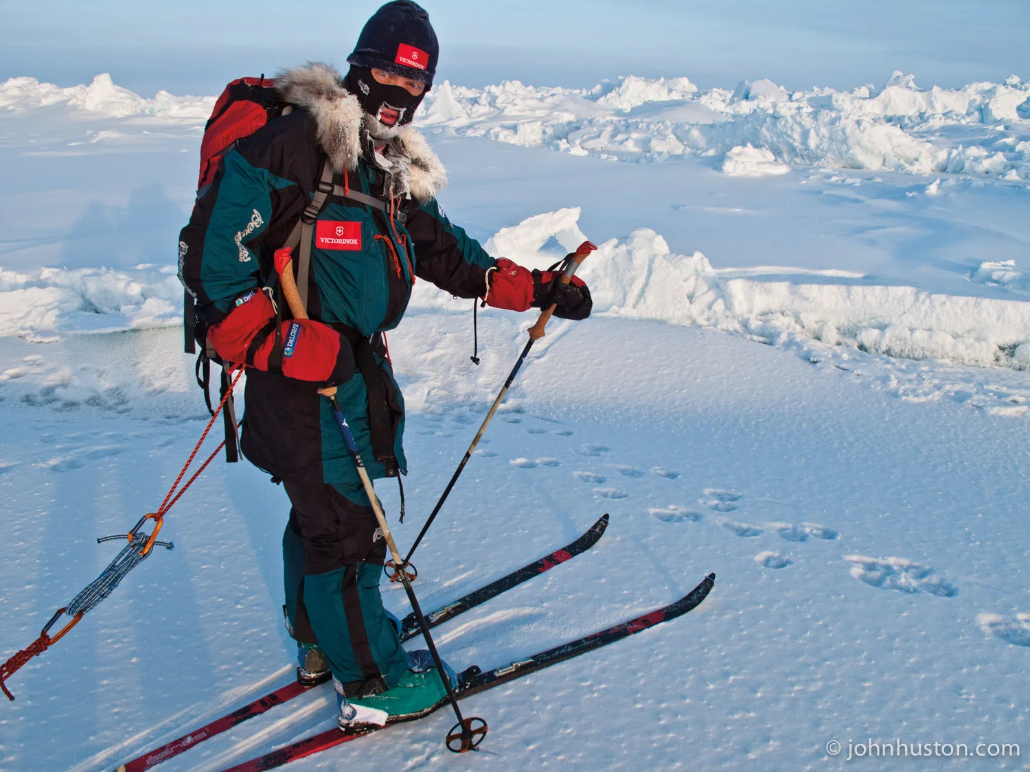
John checks out some polar bear tracks.
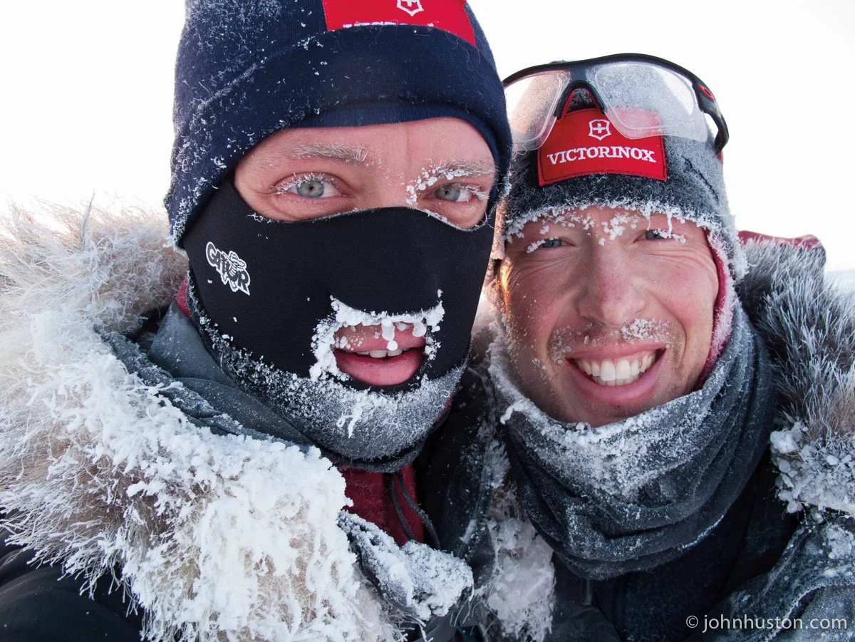
by John Huston

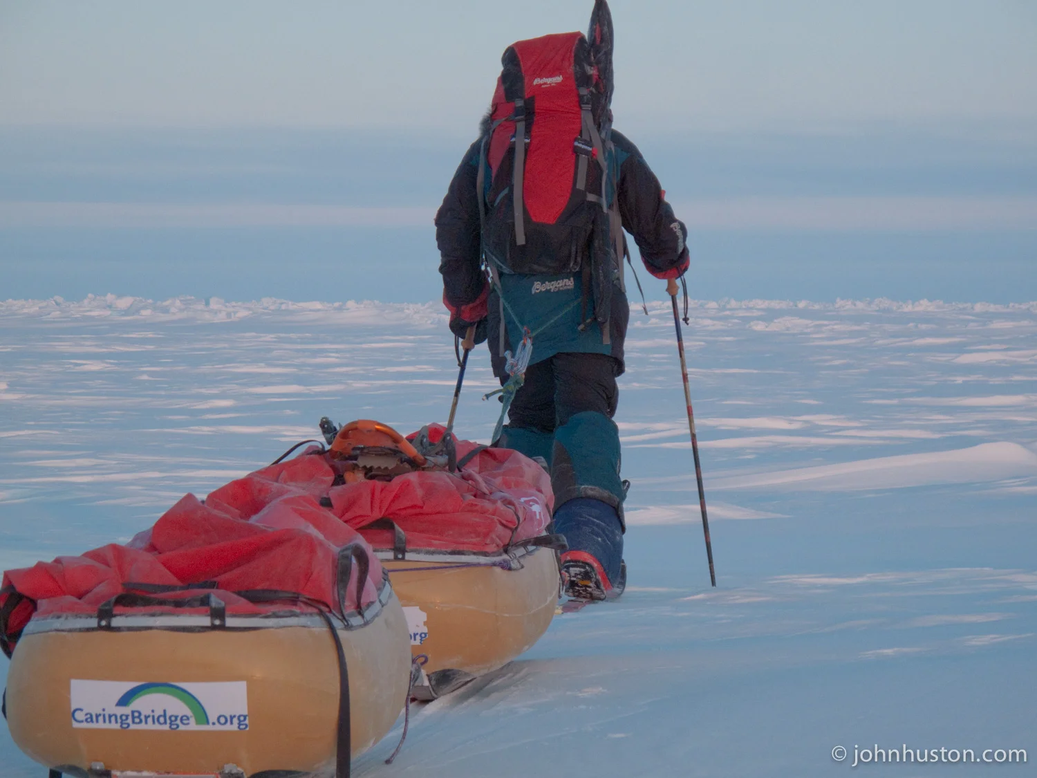
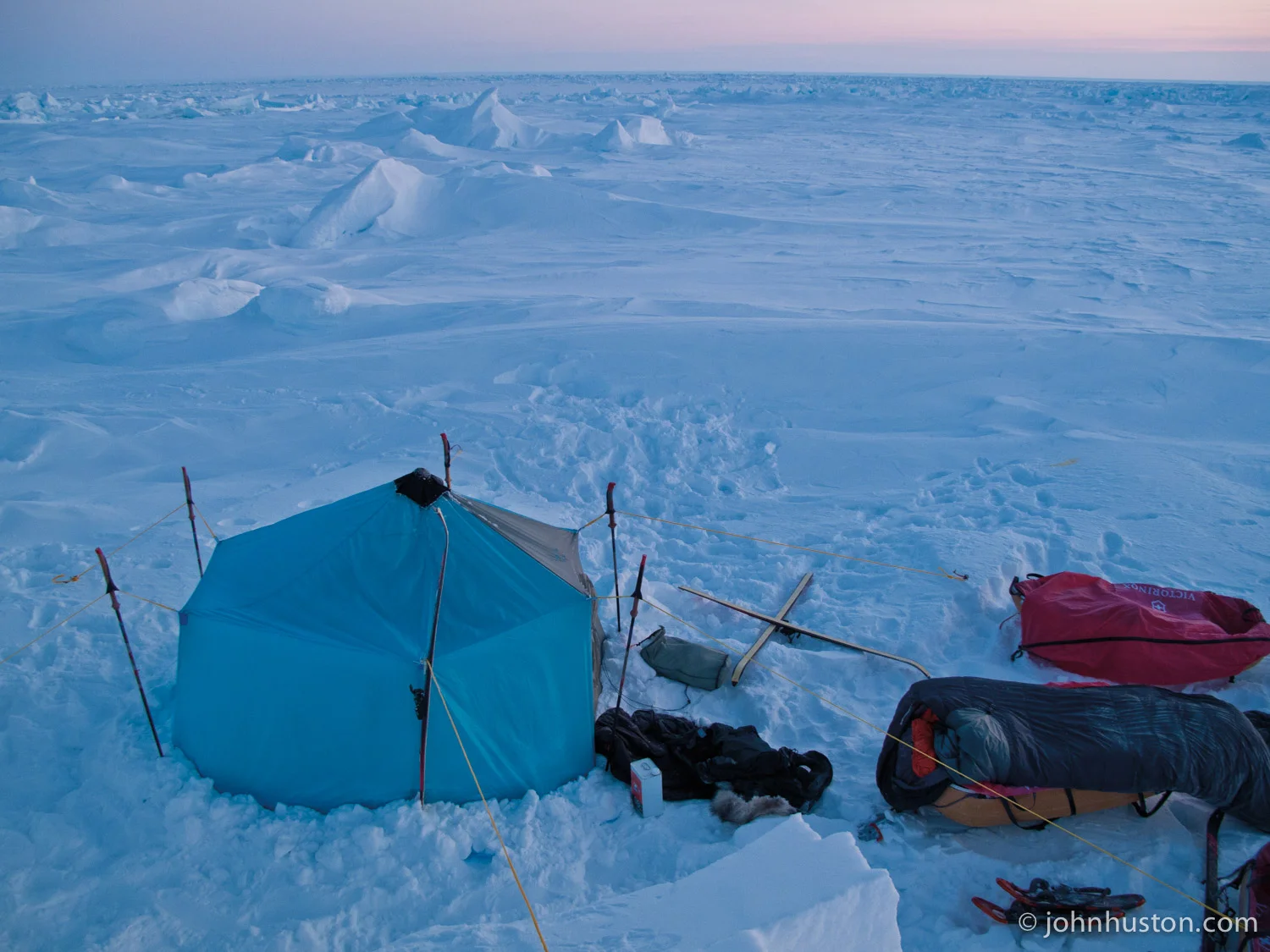
Today started out as a normal day with some heavy snow waves as we crossed old sea ice. Old sea ice features kind of small snow dunes, some two to ten feet tall with all sorts of rubble mixed in. And we dealt with that for the first few hours of the day, and actually switched over to snowshoes for the first time in a week for an hour before switching back to skis for the rest of the day.

Around noon, the ice made a transition to some newer, maybe last multi-year ice, but possibly just new one-year-old ice. And we started crossing small leads that look like they had been opened and then frozen in the past two or three weeks. On one of these leads right around noon, we saw polar bear tracks heading south-southwest, which is the opposite of our direction of travel. We looked at the tracks and it was apparent that it was a mother and two cubs. The cubs' paw prints were about the size of a baseball, three or four inches in diameter. And the mother's prints were quite large and they were eight, maybe even a little bigger, inches in diameter. And they all seem to be heading the same direction and then traveling together.
 
When we see polar bear tracks it's interesting and fun, but it also puts us on a little bit alert, so we travel closer together and take all necessary precautions to be safe. The chances of a polar bear encounter on this expedition route are very rare. But the tracks that we saw seem to be somewhat new, perhaps less than 48-hours old as identified by lack of snow cover on the tracks in the lead since it snowed 48-hours ago. But we feel good. We feel that the bears are going the opposite direction and we feel safe out here. So just to let you know that.
 
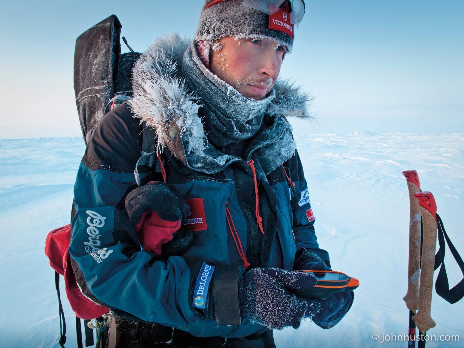
We did travel west a bit today, so perhaps we are drifting west. We will find out when we wake up in the morning, and turn on our DeLorme GPS. That's it for now. Thanks for listening. Tyler and I will have a weekly update set for you soon. Good night.

Daily Expedition Data
Date: March 21, 2009
Location: N84° 19.798' W074 43.714'
Time Traveled: 9 hours 30 minutes
Distance Traveled: 5.2 nautical miles
AM Temperature: -36°F
PM Temperature: -22°F
low contrast, light N/NE breeze
341 nautical miles to the North Pole

Day 19 - MORE CALORIES, HAPPY GUYS

Day 19 - MORE CALORIES, HAPPY GUYS

Tyler wolfs down a pemmican dinner.

by Tyler Fish 

Today was a slower day. There were many large ridges to find our way over. We ended up taking off our skis to pull our pulks, either one at a time or both at once, over these ridges. But in the end of the day, things winded down a bit and we're able to get some good skiing and make some nautical miles.

John's and my diet is based completely an energy per weight. How many calories can we get per gram? And it's a diet that is based on advice given to us by the polar explorer veteran and very nice guy, Richard Weber.

This staple of the diet is Pemmican. Pemmican has been used by explorers, historical and current, for a long time. It's meat and fat and vegetables all compressed together and then, in our case, frozen. It was made by a restaurant in Quebec and it is very good. The Pemmican we eat in the morning and in the evening. In the morning we add Minute rice to it. And in evening we add freeze-dried pasta to it.

Our lunch consist of chocolate, nuts, bacon and butter. Now what we've been doing is taking the bacon and the butter from lunch and adding it to either breakfast and/or dinner. So it's been putting the calories there and it's very tasty. So previously we've done that. But as of Day 15 we increased our calories by adding whole milk powder and some great, really tasty dehydrated cheese, which was dehydrated for us by Midwest Freeze Dry. They donated that, and we're very, very happy with our freeze-dried cheese. We've added that. We've also added butter for breakfast.

So, we no longer add the bacon and the butter, so much, from lunch into our breakfast and dinners. We're able to eat it during the day. So, this is increased our calories from 5,700 per day to now 6,700 per day. As we are needing more calories we're burning more and eating more so everything is good. So you can imagine us every morning and every evening holding our soupy, very warm breakfast or dinner, holding it for warmth. Cradling it as we turn off the stove to save fuel. So we both sit here in the cold, holding it and eating it and both of those feel good.

Daily Expedition Data
Date: March 20, 2009
Location: N84° 14.691' W074 34.747'
Time Traveled: 9 hours
Distance Traveled: 5.4 nautical miles
AM Temperature: -36°F
PM Temperature: -32°F
visibility good, light E breeze
346 nautical miles to the North Pole

DAY 18 - ROUTINES

DAY 18 - ROUTINES

by John Huston

This is John. I am going to talk about routines.  But first of all, we've learned that our friend, mentor, and Outward Bound colleague, Thor Pakosz, has been in a small plane accident and is in critical condition. He lives in northern Minnesota and we are thinking about him and sending him positive thoughts. And his family and friends have set up a CaringBridge page for Thor so that people can support him from all over. So if you want to check that out, if you know Thor, go right ahead.
 
So there's been a question on our website about our routines, so here is a short blog about how we go about every day. The alarm goes off at 5:00 a.m. and we wake up, pull the sleeping bags out of the tent, start the stoves, and then take a few hours sometimes doing little projects, journaling or just relaxing a little bit, have breakfast. Tyler cooks breakfast.

Out of the tent around 8:15 or so and then depart on our nine-hour travel day at 9:00am. We travel in 90-minute to 120-minute sessions or marches. And then after 90 minutes or about two hours passes, we stop for a short 10 or 15 minute break to drink a whole bunch of water and eat as much food as possible in that short time before we start to freeze.

So during the ski day, John thinks about his girlfriend, thinks about avocados, and he thinks about how much he loves to ski, and his family, of course. Tyler, he thinks about a lot of things, but primarily Ethan, his lovely wife Sarah, he thinks about conversations he's had in the past, and he skies along singing, which is nice to hear coming down the trail.

We end the travel day around 6:00pm or 6:15pm or so depending on how long it takes to select a nice spot to set the tent. Then it takes us about 45 minutes to put up the tent, empty our sleds, cut snow for snow blocks to melt into water, and organize everything inside the tent. We get in the tent, light up the stoves, and then we have some heat, and we start to take off our boots, take off all our layers, and relax for a few minutes before cooking dinner. And then it's pretty much quickly off to bed after that with a few hot water bottles in our sleeping bags and about 7 or 8 hours of sleep each night. So we're normally in bed by 9:30 or 10:00 in the evening. Then the next day it's up at 5:00am.

So our work day is very similar to anybody else's work day or school day. And so while you folks are going through your daily routines, you can think about us here on the ice of the Arctic Ocean and we'll think about you back home because we have lots of time to think as we ski. Well, thanks for listening.

Daily Expedition Data
Date: March 19, 2009
Location: N84° 09.479' W074 21.600'
Time Traveled: 9 hours
Distance Traveled: 5.8 nautical miles
AM Temperature: -26°F
PM Temperature: -24°F

DAY 17 - 84° AND AN ILLUSION

DAY 17 - 84° AND AN ILLUSION

View from the back.

by Tyler Fish

Hello. This is the update for March 18th. It is day 17 of the expedition. Our day began with wonderful visibility. I stood high on a mound of ice and looked to the north and I was able to see very far, which basically means that the terrain was flat. The further we could see, the flatter the terrain and we like that because it means that we'll be able to go faster. So I was able to do that and see a great distance and I watched John pull away with his two pulks.

Eventually I left and somewhere through the day we crossed 84°. There was no sign, no marker, no boundary, nobody to tell us that we had done it, but we just knew that we had been traveling fast enough and that we had done it and we were very happy about that.
 
But something did happen today. As I was skiing I noticed ahead of me, not sure how far ahead, I thought made a quarter mile or a half mile, there was a wide white expanse approaching or maybe I was approaching it and I was curious, what was this? Was it 1. A huge frozen lead or other ice formation, something new? 2. Was it a wall of weather coming towards us, perhaps of wind and snow? 3. Perhaps the world actually is flat and I was charging towards the end of the world? I wasn't sure.

Well without speed and also without hesitation, I continued and I got closer and closer, sort of excited and anxious to see what this would be. But then from far away, a small voice in my head sort of woke up, yawned, and said, "Clouds." And sure enough it was the clouds. The clouds and the horizon were playing with me to create an illusion. I was actually not heading towards any white expanse of anything at all. I was just skiing on the snow.  So there wasn't anything. It's like when you're driving down a hill in a car and you can make the clouds appear like the ocean or a lake with islands and peninsulas, that sort of thing. Just an illusion.

Shortly thereafter, the visibility steadily decreased and eventually the sun was gone and it was very hard to make out all the ups and downs in the terrain. Even though daylight has increased by an average of, we think, about 45 minutes every day, you still need the sunlight itself for the contrasts in the terrain. So the going was much, much slower. Incidentally, according to our GPS, we now have just over 12 hours of daylight from sunrise to sunset. But because we are so far north, there's actually, if you wake up in the middle of the night, there is still a little light in the sky. 
 
We ended our day with no illusions and we are soundly past 84 degrees, which is our first parallel, our first line of latitude, our first degree north from where we started. We hope the rest of them come quicker and quicker. That's it for now.

Daily Expedition Data
Date: March 18, 2009
Location: N84° 3.749' W074 12.159'
Time Traveled: 9 hours
Distance Traveled: 6.9 nautical miles
AM Temperature: -38°F
PM Temperature: -26°F
Wind: light in the AM, grew stronger
Visibility: great in the AM, grew worse, light snow in PM

DAY 16 - SEA ICE

DAY 16 - SEA ICE

Camped on a bit of old ice, surrounded by new ice.

by John Huston

This is John calling with a dispatch. Today's date, March 17th, Happy St. Patrick's Day everybody. Our 16th day of travel. Today we traveled 8 hours and 30 minutes and covered 6.0 nautical miles, our biggest day of travel so far, so we are quite happy about that.

On the Arctic Ocean we live on sea ice and it's a very dynamic environment. And sea ice is normally classified into a few different categories and today I'll talk about multi-year ice, which is called old sea ice, and new sea ice, which is just one year old. Up until recently the Arctic Ocean was, by and large, multi-year sea ice. Then starting in 2005 and continuing, there's been more and more first-year sea ice. First-year sea ice is a lot less resilient due to climate change and increases in temperature. It melts a lot faster. However, it also has less snow on it most of the time which makes it for better skiing

About half of our trip is expected to be on new sea ice, and that's the second half of the trip, from about 86 degrees north onward through the North Pole. And if you look at the National Snow and Ice Data Center graphics, which are taken off a NASA satellite, there are a few on our website and a few on the NSIDC homepage that are just fantastic, you'll see that over the past few years the old sea ice has decreased and the young sea ice, one year old, has increased by a large proportion. 2008 was the second lowest sea ice area coverage on record for the summer and that was taken in September. The previous low was last year 2007 and the previous low before that was 2005. How that impacts our expedition, we will find out.

We're camped right near a whole bunch of new sea ice that is very stable. It looks like it's perfect skiing, like one inch of snow on top of ice, and that hopefully will take us north quite a bit tomorrow. However, it makes for hard camping because we don't have ice screws, we just have snow pegs, and we need a bunch of snow to hold down the tent. We have snow flaps on the side of the tent that hold snow that's secure. So that's a little bit about sea ice. We've been traveling almost entirely over old sea ice which is why we are dealing with so many heavy snow formations.
 
All right, thanks for listening and we will check in tomorrow. Good night. Happy St. Patrick's Day everybody!

Daily Expedition Data
Date: March 17, 2009
Location: N83° 56.895' W074 10.629'
Time Traveled: 8 hours 30 minutes
Distance Traveled: 6.0 nautical miles
AM Temperature: -36°F
Wind: ~5 knots out of the SW
clear skies, sunny, good contrast

DAY 15 - NAVIGATION

DAY 15 - NAVIGATION

Tyler gets the bearing from the DeLorme PN-40 GPS.

Tyler gets the bearing from the DeLorme PN-40 GPS.

by Tyler Fish

Hello, this is the update for March 16th. It is day 15 of the expedition.

There are probably many of you out there who are wondering how we navigate our way through the Arctic Ocean, across the Arctic Ocean. Navigation is basically using something you trust to keep you heading the right direction. For example, kids hold adults' hands to keep them going the right way. We use handrails on stairways and in dark corridors; we use signs or landmarks, but we have none of these things here on the Arctic Ocean. In fact, any landmarks that we had left us. Two days ago the mountains of Ellesmere Island disappeared and we'll not be seeing them again. And the landmarks that we do have here on the ocean can be very deceiving. John and I today thought we were heading towards something that was 40 feet or higher, kind of a mountain-looking thing, and we started heading towards it and before we knew it we were at the top of it and were very surprised and disappointed to find it was really, really small. 

So we don't have landmarks in that way, so what do we use to trust? How do we navigate? We use the sun for one. We know that at 12:15, the sun is directly south of us and our shadows point directly north. We also know that the sun moves 15 degrees every hour, so we can calculate, well, if the sun is over here, it must mean this is where north is. There is a little more to it than that, but that is the gist of it. The disadvantage of that is that if it is cloudy, you don't know where the sun is. There is also the wind; if you know where the wind is coming from you can adjust your direction based on that. The disadvantage is the wind can change or maybe there is no wind.

Then there is the compass. The compass is very trusty. You can use it to find points in the distance to then head to. You do, however, need to know the difference between the magnetic north where the compass is pointing and true north, that is, towards the North Pole. And right now that difference is 77 degrees to the west; in other words, the compass points 77 degrees west of actual north. The disadvantage of that is it is nice to have visibility to use the compass. If you don't have that, it can still work, but it is a little harder.

In the end at the end of the day when we get in our tent and I reach in my pocket, I take out our trusty GPS. We use the DeLorme PN-40. This little device is the only way we can actually know our exact location, our latitude and our longitude. It also helps us figure out how far we have traveled that day, how much we have traveled in total for the expedition, and how far is left to the North Pole. This particular model also tells us the sunrise, when the moon is in the sky. And in the future, we will use this device a lot more than just at the end or at the beginning of every day. We may use it to calculate how much we are drifting on ice that is moving with currents and wind. So eventually this little PN40 will be the only way that we will actually find the Pole itself.

Daily Expedition Data
Date: March 16, 2009
Location: N83° 50.895' W074 13.882'
Time Traveled: 8 hours 30 minutes
Distance Traveled: 4.8 nautical miles
371 nautical miles to North Pole

EXPEDITION STATISTICS

EXPEDITION STATISTICS

We love to ski!

Here are a few statistics from the first couple weeks of our expedition.  Enjoy!
 
Number of frozen leads crossed so far - 15

Lowest temperature experienced - -60°F

Highest temperature - -26°F

# of times we tell ourselves that it's important to be patient - probably 25 times a day

Most high maintenance piece of equipment - the iPaq (this is a pda that allows us to send pictures via email)

Our favorite piece of clothing - Bergans of Norway Sula Fleece

The number of days the Victorinox Spirit Multi tool is used - everyday

Vital electronic equipment - DeLorme PN-40 GPS

Coldest body part - Tyler: fingers and John: thumbs

The number of incidence of frost bite - 0

# of falls average per day - 3

# of blisters - 0

# of layers worn on the feet - probably 7 to 8

Signs of wild life - we have seen fox tracks and polar bear tracks

# of hours we sleep each night - 8

# of times Tyler has fallen asleep already writing this list - 3

Favorite piece of outerwear - we love the hood of our Bergans Antarktis jackets

AM Wakeup time - we strive for 5am

# of splits/cracks on Johns hands - 10

# hours spent pulling each day - 8

# of items stuffed in sleeping bags to keep warm during the night - 4

What we do all day - pull sleds

Favorite time of day - John: last 2 hours, Tyler: middle 3 hours

Time it takes to put footwear on in morning - 15 minutes